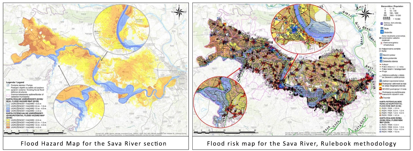
Hydro-Engineering Institute and COWI A/S Denmark have jointly implemented a project “Flood hazard and risk mapping component 2 of Serbia National Disaster Risk Management Plan (NDRMP)” in Serbia. Project started in September 2018 and was successfully finalized in December 2020.
The overall objective of the project was to contribute to harmonization of flood risk management in Serbia with the European Flood Directive. This objective was in line with Serbian Government’s European Integration Strategy. Also, a long-term objective of this project was to enhance economic development through the reduction of flood damages.
The specific objectives of this assignment was to enable the Government of Serbia, and particularly the Serbian water sector institutions under Ministry of Agriculture, Forestry and Water Management, generate actionable flood risk information and strengthen flood risk assessment methodologies.
The results of achieved were as follows:
- Flood hazard and risk maps for the selected APSFR developed
- Flood hazard and risk maps incorporated into WIS, and
- The water sector institutions developed capacities for flood hazard and risk mapping

The services provided by HEIS under this assignment included:
- Capacity development: The Beneficiaries assigned the counterpart staff to work with the Consultant and get educated and trained on the job. The Consultant was developing the capacity of the counterpart staff on the job as well as through specialized training programs, so they can undertake similar work in future on their own.
- Training plan: At the start of the project, the Consultant prepared a detailed training plan of Beneficiaries’ staff on flood hazard and risk modelling throughout the project. The training plan included the subjects as follows: pre-processing the necessary data, transfer of data to and from WIS, hydrological and hydraulic model set up and performing model runs for calibration/validation, preparing flood hazard and risk maps, entry of data/maps into WIS, etc.
- Guidelines Flood Hazard and Risk Mapping: The Consultant prepared flood hazard and risk maps for the areas under consideration, following the directions of the EU Flood Directive, the Serbian “Rulebook establishing the Methodology for the development of Flood Hazard and Risk Maps” and other relevant documents.
- Overview of the activities:
The work of the Consultant included the following activities for all APSFRs under consideration in this project:
- Data collection, quality and processing/deliverable Data Report
- Topographic data
- Hydrological data
- Hydraulic data
- Risk receptors data
- Reporting Data collection and management
- Project Methodology / deliverable Methodology Report
- Data processing and accuracy analysis
- Flood Hazard Modelling
- Flood Risk modelling
- Reporting Methodology
- Production of Flood Hazard Maps/deliverable Flood Hazard Report
- Hydrological and hydrodynamic model setup
- Model calibration/validation
- Preparation of flood hazard maps for chosen flood scenarios
- Report of Flood Hazard
- Production of Flood Risk Maps/Deliverable Flood Risk Report
- Preparation of flood risk maps
- Report of Flood Risk
- Integration into Water Information System
- Dissemination of results
- Flood Risk workshop
- Training and capacity building